
Here is a particular case that has happened in South Galway that is makes for a very worrying scenario – what happens when experts get it wrong?
The pinch point – Kiltartan
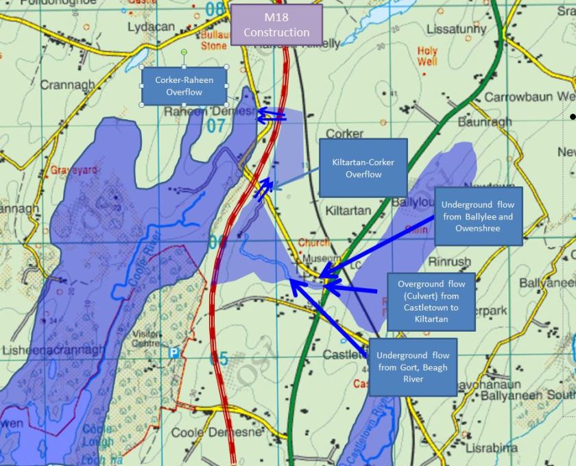
I’ve detailed before how most of the Slieve Aughty drainage flows through Kiltartan, from three sources – Ownshree (Kilchreest) river , Boleyneendorish (Ballylee) river and the Owendalulleegh (Beagh/Gort ) river. These flow underground into Kiltartan. Kiltartan then flows underground into Coole and when Coole lake rises the Kiltartan swallow hole loses pressure and doesn’t flow as fast and causes the levels to rise. In severe rainfall, this builds up in Kiltartan until it finds another path to Coole, typically across the road into Corker and around Raheen. This detailed below.
Creating Flooding
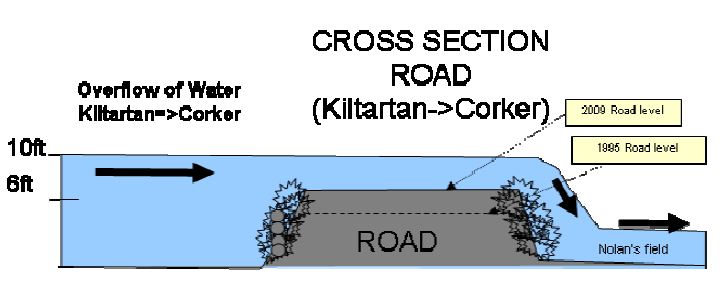
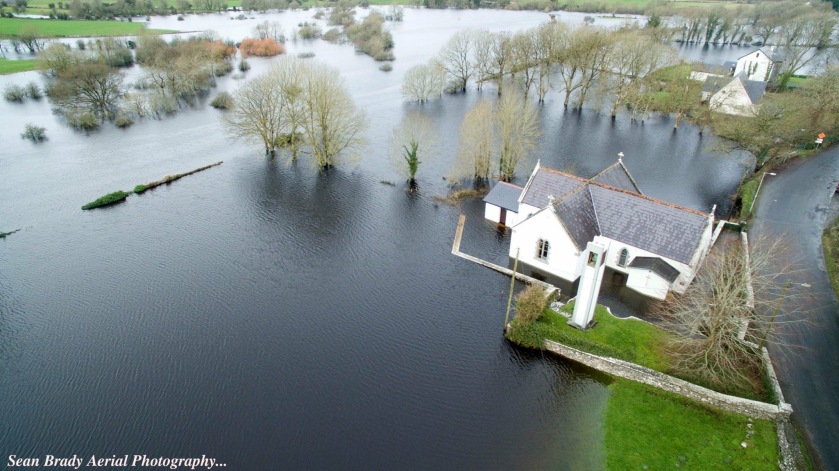
I won’t get into all the details here but there have been some incredible blunders in dealing with this overflow in the past. Firstly, the road that it flowed across was continuously raised several feet over the years, creating an actual dam across the overflow. Note – if there is water on this road – there is water in the church in Kiltartan.
The first time the road was raised I can understand ignorance by the OPW/County Council of the fact that this was an overflow and not static water and that raising the road was akin to building a dam.
After severe flooding in 1995, when 2ft level of water flowed across the road, they raised the road by another 2ft. They did put 2 x 12-inch pipes across it which when given the flows that year was completely unrealistic.
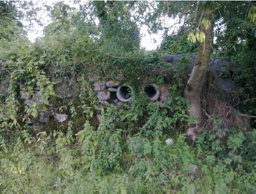
Fact! : Even worse than the small sizing of the pipes was that they pipes didn’t make it all the way through to the far side. Incompetence? Apathy – ‘Shur it’ll never happen again?’
In 2009, the worst flooding yet – there was yet again, 2ft-3 torrent of water flowing across the road. (this was supposed to be carried in those 2 12-inch pipes)
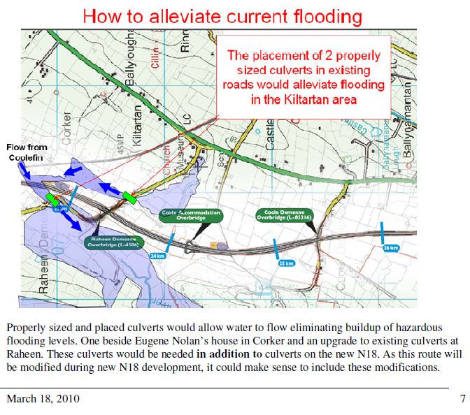
I decided to do away with the ‘ignorance’ factor and took it upon myself to detail the exact situation in Kiltartan. After highlighting to the OPW and County council in a report I did on Flooding at Kiltartan and Kiltartan_Kinvara_Flooding_Analysis – I requested ‘properly-sized culverts’ to take this water across from Kiltartan to Corker . I produced videos of the flows (above) and explained that the raising of the roadway had been a significant dam on what is a natural overflow channel and highlighted it in these as in the picture below:
After analysis of all their data and with reference to my own report they calculated the following: (Please follow the numbers)
- The peak flow into Kiltartan is estimated at 83.9 m3/s (Cubic metres/second)
- The Overground Flow is 54.5m3/s (some of it will still be going underground) is
- With contingency (climate change etc) the overground glow it’s estimated at 100 m3/s. That’s the final number 100 m3/s
This seems reasonable – However what did they do? They measured an ancient culvert in Raheen and figured out that it could take flows of around 30M3/s. They noted that it was completely overrun in 2009 flooding. What did they do?
Jennings O’Donovan recommended a culvert in Kiltartan at 30 m3/s when they had calculated a 100 m3/s rate.
They OWP proceeded with this and we can see the result of that decision here when a few weeks ago there was still 2-3 ft of water flowing across the road (Notice the the culvert railings in the middle)
Local knowledge had been detailed in reports and was discussed with OPW/Jennings O’Donovan. These videos were shared and ‘properly-sized’ culverts were requested. They did their calculations and then completely messed up the recommendation! Bizarrely they recommended in that report “For any new culverts such as the culvert to be considered under the M18, it is proposed to consider 100 m3/s.”. This makes no sense!
We are consistently told ‘Leave it to the experts’ but this example is a real spurn at local knowledge where despite communicating the issue the ‘experts’ get it wrong.
It’s not the experts that have to live with the consequences -it’s the local community which should be surrounded by green fields this time of year.
As stated initially, this is an example of what happens, sometimes despite the best intentions, of our flood alleviation planning.
In the meantime, what happens if they get it wrong for the M18?
-David Murray

Keep up your great work David. Some day “the experts” might just listen to the locals like yourself on the ground and do something constructive which would solve the problem of flooding.
LikeLiked by 1 person
Thanks Bridie. Let’s keep the pressure on! Cheers. Dave.
LikeLike
Bridie – can you txt me your number – (0868097223)
LikeLike